The goal of this lab is to determine which vector geoprocessing tool to use in a given situation and apply that tool correctly. In this lab, we will use the tools to find suitable habitats for bears in Marquette County Michigan. We will use GPS locations of black bears and fit their locations with a suitable forest habitat. Other criteria like proximity to streams will also be used to determine the best habitat for bears. The lab will also introduce basic scripting in python for ArcGIS with vector geoprocessing tools.
Methods:
To start, I downloaded
the data and created a feature class for bear locations based off of XY
coordinates from an excel sheet. I then used the intersect tool with the
bear locations and landcover feature classes to combine the bear ID and habitat
type fields to find the three most popular habitat types the bears were
found in. Then I found how many bears were found within 500 meters
of streams to determine if that was a popular location for them. I
buffered the streams and intersected that outcome with the bears
locations. The majority of bears were found near streams. I then
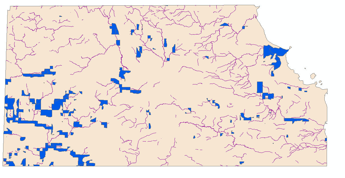
used the popular land cover types and the proximity to streams to find general
suitable habitat for the bears. I made a layer by selecting the bears
three most popular landcover types and intersected that with the proximity to
streams layer. After dissolving the boundaries within the layer, I got a
map of suitable bear habitat (figure 1). The next objective was to find
suitable habitat that was on DNR management land. I used dnr_mgmt layer
and used the clip tool to get it only within the study layer and not the whole
county, and then the dissolve tool to get rid if the internal units. Next
I intersected the modified dnr_mgmt layer with the previous suitable bear
habitat layer and got suitable land within dnr boundaries (figure 2). The
next step involved changing the suitable bear habitat layer to exclude areas
within 5 kilometers of Urban or Built Up lands. I selected Urban
from the landcover feature class and dissolved it. I then
applied the 5 km buffer using the Buffer tool and used the Erase tool to
erase it from the suitable bear habitat (figure 3). For the second part
of the lab, I used python scripting to find areas in Wisconsin that are
suitable for the development of resorts (figure 5). I created a 10 miles buffer
around cities and wrote code to select by attribute for lakes greater than 5
sq. mi. For the second task of part 2, I wanted to create potential impact zones of air pollution around interstates in Wisconsin. In python scripting, I used code for a multiple ring buffer around interstates and created a graduated colors map (figure 6).Results:
 | ||
Figure 1: All suitable habitat for bear within the study area of Marquette county
|


No comments:
Post a Comment